Editor’s Note: For maximum understandability, please first read this article’s contextual prerequisite: Where The Buffalo Roamed.
To me, as a kid, McDonald’s was a monolith: immutable and, barring an act of God, indestructible. After St. Peter let you pass through the Pearly Gates, he’d bop down to the local Micky Dee’s, mow through the super-sized #7 meal, and grab a soft-serve vanilla cone for the road.
Now, if McDonald’s truly did last forever, and every year, corporate opened X% more? Why, that’s the recipe for Exponential McGrowth! From an overlook above town, buddies, beer, and high-school I pondered… Would it end in the salty pleasures of McNirvana? Or a fast food adaptation of the gray goo, featuring a countryside gradually swamped by a layer of cast-off straws, fumbled McNuggets, and similarly durable pieces parts?
“lol dudes,” dad me interjects, “but McDonald’s do shut down, and more often than you might expect!” Witness this message, emailed to Yours Truly by a McInterested Party:
We are in Round Mountain Nevada. There was a McDonalds in Tonopah Nevada 45 miles away. Since it closed we now have to drive 158 miles to Battle Mountain to the nearest McDonalds. [...] I don’t think we are the furthest point but it must be close.
Had the McFarthest Spot, the place most distant from a McDonald’s in the Lower 48 states, which I’d last calculated eight years ago, changed? Clearly, this required investigation, and now, as a byproduct of Thanksgiving slack…
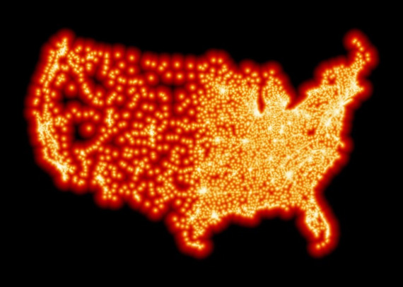
Behold the interactive 2018 update to the Contiguous United States as Visualized by distance to the nearest Mcdonald’s:
Click above to launch an zoomable map of the domestic McField.
For the map connoisseurs: the color of each pixel represents the geodetic distance to the nearest U.S. McDonald’s, as located by a recent scrape, rendered as Web Mercator tiles using Proximatic, and warped to an EPSG:2163 National Atlas Equal Area projection via OpenLayers and proj4 plus some rotation code to keep north pointing more-or-less up.
In our map, scattered McDropouts pepper the rural West. However, the McNetwork features high availability, and for almost every town that lost its Micky Dee’s, like John Day, Oregon or Mammoth Lakes, California, there’s a functional backup McTransmitter within an hour.
The outlier? Tonopah, Nevada, better suited to metaphors with nubby tires, wherein an irresistible McHankerin’ helps you into his rig, wheels you all the way Up S*** Creek, then busts a McAxle.
You see, Tonopah’s was amongst the most isolated of McOutposts, and as its fryer blooped a final bubble, the surrounding McFrontier sprang forth and multiplied.
At its center, by my calculations, forty minutes of washboard south from the Extraterrestrial Highway and a few klicks to the civilian side of the greater Area 51 perimeter fence, you’ll find the Lower-48′s currently McFarthest Spot: a sandy swatch of Silver State sagebrush, just over 120 miles, as the crow flies, from the nearest McDonald’s! 1,2,3
Upon this revelation, my first order of business was to retrieve the McFarthest geocache, which, now beknownst to me, sat in a stale location. Had it survived eight years in the high desert, and, if so, did anyone ever visit? Vegas noted the possibility of Brownian Burners and set the latter odds at 50/50.
The cache and its original contents – a space blanket, Happy Meal toy, and casino chip – were intact and undisturbed. In fact, but for my footprints and a thin layer of UV haze on the Tupperware, everything looked the same. Way out there, time unwinds at geological speed.
Disclaimer: For the record, the prior two paragraphs are 100% fictional: because the Feds get all cold-prickly about people hiding-and-seeking things in designated wildlife refuges. And little old me? Break the law? Intentionally? Good golly, never ever, I swear.
Happily, McFarthest Spot 2018 is on BLM land, the type of government property traditionally marked on maps as “anything goes.” So, next spring, after the Sierra thaws, I shall hitch up the mules, cross Tioga Pass to yonder Nevada, and emplace McFarthest Geocache v2.0.
As do all journeys through the desert, it will come with a story, so… Stay tuned!
