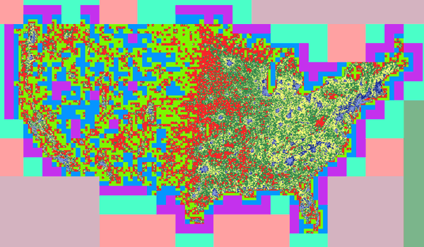
Here’s a “behind the scenes” image that might strike you as interesting, eye candy, or perhaps both, depending upon your particular inclination and intimate knowledge of online map tiles:
That’s the contiguous United States, colored at each point by the zoom level of the smallest enclosing Google Maps tile wherein 1,000 or more people live, according to 2010 block-level Census data. Periwinkle represents zoom level 14+, navy blue 13, yellow 12, dark green 11, and so on.
The über-geek backstory? Last Friday, I told my Data Elves to get slippy – and create interactive Map X, featuring our own custom imagery, zoomable from continental down to “city core” scale, five-or-so miles across the browser window.
Eager to scope the project, the Elves grabbed an envelope, flipped it over, and made some calculations. We’d be rendering down to Google’s zoom level 14, and to cover the entire world, how many map tiles would we need to create? 357,000,000… each a 256×256 pixel image. The room buzzed with squeaky chatter about the “cloud” and FedEx-ing hard drives.
“Wait a sec,” I said, “Map X is U.S. only.” A mere 10,000,000 tiles would fill the bounding boxes of the Lower 48, Alaska, and Hawaii. Which certainly was a more manageable number, but still enough to make my compute farm sweat.
Could we do better? Yes!
Because, for the subject matter of Map X, detail correlates with population, and we could focus on the places where people live. Thus directed, the Elves mashed Census data with tile geography, applied the 1,000+ “interestingness” criteria, and the above image was born.
My team selected the old-school color scheme to maximize contrast whilst maintaining some semblance of readability. According to them, if it dredges up any repressed 8-bit feelings – like the urge to snipe an Atari 2600 off Ebay – that’s not a bug. It’s a feature.
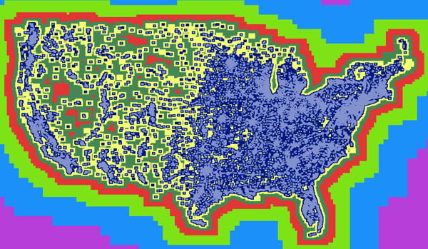
Finally, the Elves added some padding – five tiles horizontally and four vertically – for the sake of context and to prevent solitary areas of interest from being marooned in “no imagery available at this zoom level”:
This scheme renders everything near urban areas in full detail, while displaying the most desolate pockets of the American West at enough magnification to keep 99.44% of the three people who look out there happy. Total number of tiles: a cool 1,000,000.
The takeaway? Those crafty Elves pruned the naïve Map X render by a factor of ten, earning them their quarterly bonus: seven nights on Maui, all expenses paid. Aloha, little buddies!

